
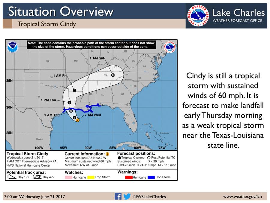
The National Weather Service in Lake Charles reports Tropical Storm Cindy has sustained winds of 60 mph as it moves northwest across the Gulf of Mexico. Landfall projections bring it to the Texas-Louisiana state line by early Thursday morning, but we will see impacts before then. A tropical storm warning and a flash flood watch is in effect for our entire region. Winds will be gusting to tropical storm force this morning in parts of south central Louisiana this morning, and extend into southwest Louisiana and southeast Texas this afternoon. Rain bands will be moving across the region today and tomorrow, producing 3 to 5 inches of rain. If a rain band ends up sitting in one location, it has the potential to produce as much as 10 inches of rain. Some street flooding is expected across the region due to the poor drainage conditions due to the saturated grounds and above normal tides. At the coast, tides will run 1.5 to 3 feet above normal today and Thursday. This will cause some street and property flooding in and near Sabine Pass, including sections of Highway 87 between Sabine Pass and Port Arthur, low areas in Bridge City, parts of Highway 82 west and east of Holly Beach, downtown Cameron, Pecan Island, Intracoastal City, Delcambre, Cypremort Point, and Burns Point. There will be a slight risk for tornadoes today and tomorrow across the region.